2013
TF1703 : Cuckoo's Hollow, Werrington
taken 11 years ago, near to Werrington, Peterborough, England
This is 1 of 2 images, with title Cuckoo's Hollow, Werrington in this square
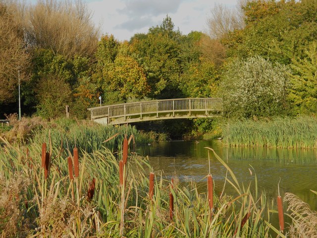
Cuckoo's Hollow, Werrington
Originally an area of pastureland surrounded by dikes, Cuckoo's Hollow was turned into a public park by Peterborough Development Corporation in the late 1970s by creating an artificial lake with an island, planting trees and constructing a network of paths and footbridges. The island has evolved into a breeding ground for ducks and other waterfowl.
Source: Link (Archive Link )
Source: Link
 Map © Crown Copyright")
TIP: Click the map for more Large scale mapping
- Grid Square
- TF1703, 51 images (more nearby 🔍)
- Photographer
- Paul Bryan (more nearby)
- Date Taken
- Saturday, 19 October, 2013 (more nearby)
- Submitted
- Friday, 25 October, 2013
- Subject Location
-
OSGB36:
 TF 1750 0399 [10m precision]
WGS84: 52:37.2583N 0:15.9438W - Camera Location
-
OSGB36: TF 1747 0397
- View Direction
- Northeast (about 45 degrees)