2013
SP3378 : The Rocket, Warwick Road
taken 10 years ago, near to Coventry, England
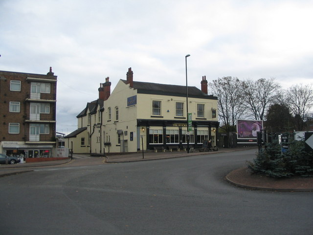
The Rocket, Warwick Road
The Rocket started out as the Railway Inn in 1838 and stood to the left of the first Coventry station which also opened in that year. It was renamed the Rocket after major refurbishment in the early 1960s. The station building survived to the late 1950s when it was demolished to make way for a small multi-storey car park which was, some years later, found to have defects and was also demolished. The current station stands behind the Rocket at a lower level.
The small roundabout in the foreground was introduced to ease access from Warwick Road into the adjacent Central Six retail park but congestion still occurs at times.
The small roundabout in the foreground was introduced to ease access from Warwick Road into the adjacent Central Six retail park but congestion still occurs at times.
 Map © Crown Copyright")
TIP: Click the map for more Large scale mapping
- Grid Square
- SP3378, 1564 images (more nearby 🔍)
- Photographer
- E Gammie (more nearby)
- Date Taken
- Saturday, 26 October, 2013 (more nearby)
- Submitted
- Sunday, 27 October, 2013
- Subject Location
-
OSGB36:
 SP 3306 7827 [10m precision]
WGS84: 52:24.0870N 1:30.9306W - Camera Location
-
OSGB36: SP 3303 7831
- View Direction
- Southeast (about 135 degrees)