2013
TR0764 : Faversham Road, Seasalter
taken 10 years ago, near to Seasalter, Kent, England
This is 1 of 4 images, with title Faversham Road, Seasalter in this square
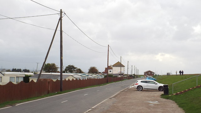
Faversham Road, Seasalter
Faversham Road forms part of National Cycle Network route 1, which links Dover with John o'Groats.
The grassy bank to the right of the image is a flood defence.
The grassy bank to the right of the image is a flood defence.
The National Cycle Network
The National Cycle Network is a network of cycle routes. It was created by the charity Sustrans Link
(Sustainable Transport), aided by a National Lottery grant.
Many routes aim to minimise contact with motor traffic, though 70% of them are on roads. In some cases the NCN uses pedestrian routes, disused railways, minor roads, canal towpaths, or traffic-calmed routes in towns and cities.
National Cycle Network Route 1
National Route 1 of the National Cycle Network is a long distance cycle route connecting Dover and the Shetland Islands mainly via the east coast of England and Scotland. The route is all signed and open except between London and Woodbridge (in Suffolk) and between Whitby and Staithes (in Yorkshire).
 Map © Crown Copyright")
TIP: Click the map for more Large scale mapping
- Grid Square
- TR0764, 50 images (more nearby 🔍)
- Photographer
- Malc McDonald (more nearby)
- Date Taken
- Saturday, 26 October, 2013 (more nearby)
- Submitted
- Sunday, 27 October, 2013
- Subject Location
-
OSGB36:
 TR 0722 6496 [10m precision]
WGS84: 51:20.7559N 0:58.4477E - Camera Location
-
OSGB36: TR 0725 6496
- View Direction
- WEST (about 270 degrees)