2013
TM3569 : Church Street, Peasenhall
taken 10 years ago, near to Peasenhall, Suffolk, England
This is 1 of 4 images, with title Church Street, Peasenhall in this square
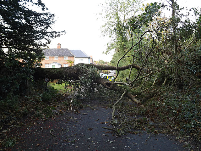
Church Street, Peasenhall
After the storm. At the junction with Smythe Close. Road no. C229.
 Map © Crown Copyright")
TIP: Click the map for more Large scale mapping
- Grid Square
- TM3569, 456 images (more nearby 🔍)
- Photographer
- Geographer (more nearby)
- Date Taken
- Monday, 28 October, 2013 (more nearby)
- Submitted
- Monday, 28 October, 2013
- Subject Location
-
OSGB36:
 TM 35636 69126 [1m precision]
WGS84: 52:16.1857N 1:27.1317E - Camera Location
-
OSGB36: TM 35636 69126
- View Direction
- North-northwest (about 337 degrees)