2013

ST2107 : A30 crossroads

taken 11 years ago, near to Upottery, Devon, England
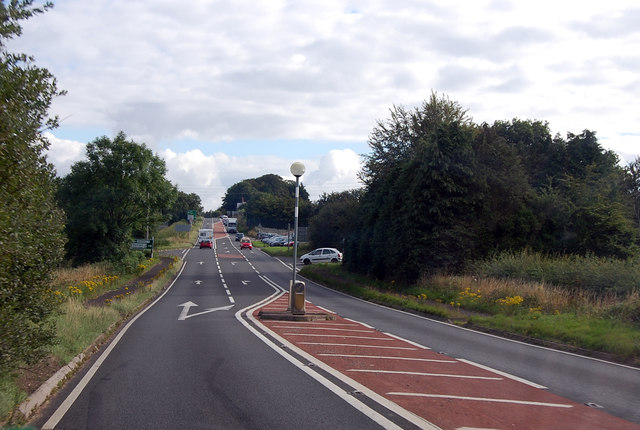
A30 crossroads
A30 crossroads
Heading north east, the road is about to merge into the A303. In fact the A30 is a right turn to Crewkerne and Chard.
A30 Road

The A30 is 284 miles long, from central London to Land's End, historically known as the Great South West Road. The M3 and A303 now are the preferred route for most travellers. Only part of the road is still a trunk road.
Wikipedia: LinkExternal link


Creative Commons Licence [Some Rights Reserved]   © Copyright Julian P Guffogg and licensed for reuse under this Creative Commons Licence.
Geographical Context: Roads, Road transport Road: A30 Near: Upottery other tags: Crossroads Click a tag, to view other nearby images.
This photo is linked from: Automatic Clusters: · A303 [16] · A30 [15] · Crossroads [2] · Heading North East [2] ·
1:50,000 Modern Day Landranger(TM) Map © Crown Copyright
+
+
1:50,000 Modern Day Landranger(TM) Map © Crown Copyright
TIP: Click the map for more Large scale mapping
Grid Square
ST2107, 22 images   (more nearby 🔍)
Photographer
Julian P Guffogg   (more nearby)
Date Taken
Monday, 12 August, 2013   (more nearby)
Submitted
Friday, 1 November, 2013
Subject Location
OSGB36: geotagged! ST 2157 0719 [10m precision]
WGS84: 50:51.5329N 3:6.9417W
Camera Location
OSGB36: geotagged! ST 2148 0707
View Direction
Northeast (about 45 degrees)
Clickable map
+
NW N NE
W Go E
SW S SE
Image classification(about): Geograph
This page has been viewed about 37 times
You are not logged in login | register