2013
NS4886 : The Endrick Viaduct
taken 11 years ago, near to Croftamie, Stirling, Scotland
This is 1 of 8 images, with title The Endrick Viaduct in this square
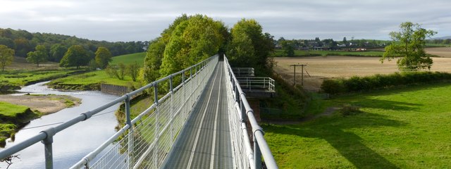
The Endrick Viaduct
See NS4886 : The Endrick Viaduct for more information, and NS4886 : The Endrick Viaduct for a side view.
In the present picture, a wide-angle view, the Endrick Water can be seen on the left, and the village of Croftamie in the right background.
In the present picture, a wide-angle view, the Endrick Water can be seen on the left, and the village of Croftamie in the right background.
 Map © Crown Copyright")
TIP: Click the map for more Large scale mapping
- Grid Square
- NS4886, 55 images (more nearby 🔍)
- Photographer
- Lairich Rig (more nearby)
- Date Taken
- Friday, 11 October, 2013 (more nearby)
- Submitted
- Friday, 1 November, 2013
- Subject Location
-
OSGB36:
 NS 4842 8651 [10m precision]
WGS84: 56:2.8431N 4:26.1110W - Camera Location
-
OSGB36: NS 4845 8653
- View Direction
- West-southwest (about 247 degrees)