2013
NN2833 : Summit of Beinn Udlaidh ('dark or gloomy hill')
taken 10 years ago, 3 km from Arichastlich, Argyll And Bute, Scotland
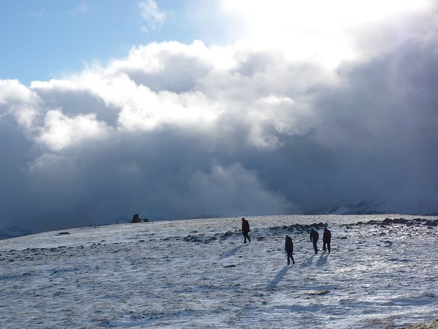
Summit of Beinn Udlaidh ('dark or gloomy hill')
Approaching the summit cairn (which doesn't seem to be quite on the true summit), where there is also the remains of a transmitter or aerial, which has not been robust enough to withstand the conditions up here.
 Map © Crown Copyright")
TIP: Click the map for more Large scale mapping
- Grid Square
- NN2833, 9 images (more nearby 🔍)
- Photographer
- Alan O'Dowd (more nearby)
- Date Taken
- Sunday, 3 November, 2013 (more nearby)
- Submitted
- Monday, 4 November, 2013
- Subject Location
-
OSGB36:
 NN 2802 3327 [10m precision]
WGS84: 56:27.6062N 4:47.5624W - Camera Location
-
OSGB36: NN 2803 3329
- View Direction
- South-southwest (about 202 degrees)