2013
J4668 : Residential development site, Comber (1)
taken 10 years ago, near to Comber, Co Down, Northern Ireland
Residential development site, Comber (1)
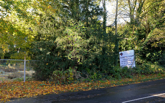
The development site is behind the trees.
Residential development site, Ballydrain Road, Comber
A site, on the western/south western side of the Ballydrain Road J4668 : The Ballydrain Road, Comber, near the Killinchy Road, which was to have been developed with detached and semi-detached houses. All photographs submitted by me appear as a matter of geographical and historical record only. I have no connection with any of the parties involved in the development and sale.
The site is the subject of the following application for planning permission (8 May 2015) LA06/2015/0150/F Residential development consisting of 10 no. detached dwellings and associated site works 3 and 5 Ballydrain Road Comber Co Down.
Loading map... (JavaScript required)
- Grid Square
- J4668, 76 images (more nearby 🔍)
- Photographer
- Albert Bridge (more nearby)
- Date Taken
- Monday, 4 November, 2013 (more nearby)
- Submitted
- Monday, 4 November, 2013
- Subject Location
-
Irish:
 J 464 685 [100m precision]
WGS84: 54:32.6190N 5:44.2653W - Camera Location
-
Irish: J 464 685
- View Direction
- South-southwest (about 202 degrees)