2013
NH1221 : Path by Loch Coulavie
taken 10 years ago, near to Loch Coulavie [water Feature], Highland, Great Britain
Path by Loch Coulavie
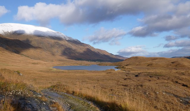
This rough path/track runs past Loch Coulavie, and along the north side of Loch Affric.
Looking across rough moorland towards Loch Coulavie. The hills of An Tudair and Sgùrr na Lapaich to the left, some snow on the tops.
Looking across rough moorland towards Loch Coulavie. The hills of An Tudair and Sgùrr na Lapaich to the left, some snow on the tops.
 Map © Crown Copyright")
TIP: Click the map for more Large scale mapping
- Grid Square
- NH1221, 6 images (more nearby 🔍)
- Photographer
- Craig Wallace (more nearby)
- Date Taken
- Monday, 4 November, 2013 (more nearby)
- Submitted
- Tuesday, 5 November, 2013
- Subject Location
-
OSGB36:
 NH 1290 2127 [10m precision]
WGS84: 57:14.6251N 5:6.1450W - Camera Location
-
OSGB36: NH 12878 21258
- View Direction
- Northeast (about 45 degrees)