2013
SZ3589 : Yar Bridge
taken 11 years ago, near to Norton, Isle of Wight, England
This is 1 of 3 images, with title Yar Bridge in this square
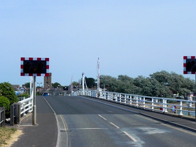
Yar Bridge
Swing bridge across the River Yar at Yarmouth.
A3054 Road
The A3054 forms the Northern half of the circular loop around the Isle of Wight; the southern half being the A3055 (The Isle of Wight Military Road). It connects the two largest towns on the Island, Newport and Ryde, as well as continuing to West Wight.
 Map © Crown Copyright")
TIP: Click the map for more Large scale mapping
- Grid Square
- SZ3589, 557 images (more nearby 🔍)
- Photographer
- David Dixon (more nearby)
- Date Taken
- Tuesday, 16 July, 2013 (more nearby)
- Submitted
- Thursday, 28 November, 2013
- Subject Location
-
OSGB36:
 SZ 3511 8954 [10m precision]
WGS84: 50:42.2667N 1:30.2502W - Camera Location
-
OSGB36: SZ 3505 8953
- View Direction
- East-northeast (about 67 degrees)