2007
SX2869 : Tokenbury Corner
taken 17 years ago, near to Pensilva, Cornwall, England
This is 1 of 2 images, with title Tokenbury Corner in this square
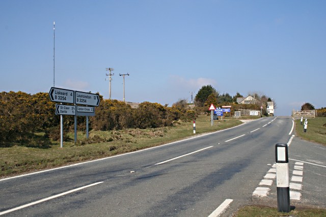
Tokenbury Corner
This is the high point on the road between Liskeard and Launceston. Here the road reaches 260 metres as it skirts the eastern edge of Caradon Hill. This is also the turning for Pensilva.
 Map © Crown Copyright")
TIP: Click the map for more Large scale mapping
- Grid Square
- SX2869, 24 images (more nearby 🔍)
- Photographer
- Tony Atkin (more nearby)
- Date Taken
- Saturday, 24 March, 2007 (more nearby)
- Submitted
- Sunday, 25 March, 2007
- Subject Location
-
OSGB36:
 SX 2805 6982 [10m precision]
WGS84: 50:30.1722N 4:25.5659W - Camera Location
-
OSGB36: SX 2807 6972
- View Direction
- North-northwest (about 337 degrees)