2013
SP8413 : Aylesbury: Pond by Bear Brook
taken 10 years ago, near to Broughton, Buckinghamshire, England
This is 1 of 2 images, with title Aylesbury: Pond by Bear Brook in this square
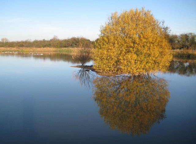
Aylesbury: Pond by Bear Brook
When the Aylesbury Flood Alleviation Scheme was being planned and built an existing low-lying area near the prone to flood Bear Brook was excavated to make this pond. The small island in the middle seen here was designed as a refuge for roosting birds.
The boundary between the Civil Parishes of Aylesbury, to the left, and Bierton with Broughton, to the right, runs more or less down the middle of the pond.
The boundary between the Civil Parishes of Aylesbury, to the left, and Bierton with Broughton, to the right, runs more or less down the middle of the pond.
 Map © Crown Copyright")
TIP: Click the map for more Large scale mapping
- Grid Square
- SP8413, 36 images (more nearby 🔍)
- Photographer
- Nigel Cox (more nearby)
- Date Taken
- Sunday, 1 December, 2013 (more nearby)
- Submitted
- Monday, 9 December, 2013
- Subject Location
-
OSGB36:
 SP 8414 1395 [10m precision]
WGS84: 51:49.0712N 0:46.8443W - Camera Location
-
OSGB36: SP 8414 1393
- View Direction
- NORTH (about 0 degrees)