2013
TF4610 : Boats on the River Nene in Wisbech
taken 10 years ago, near to Wisbech, Cambridgeshire, England
This is 1 of 2 images, with title Boats on the River Nene in Wisbech in this square
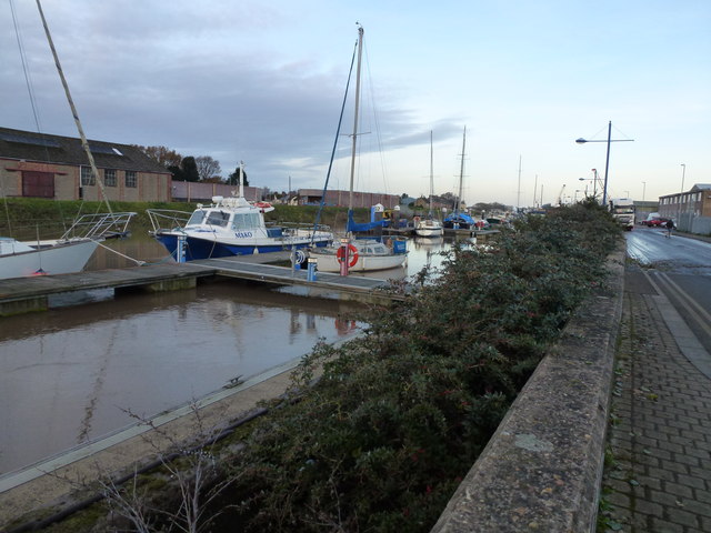
Boats on the River Nene in Wisbech
The entire east coast was battered by a 1-in-60 year tidal surge on the night of Thursday 5th December 2013. A combination of a spring tide, 60 mph winds and a North Sea tidal surge caused the highest tides in over 60 years. Although Wisbech is 10 miles from the coast and 20 miles from the North Sea it is still a flood risk area as it sits on the banks of the tidal River Nene. After parts of the town were flooded in 1978 the height of the river banks was raised by about 1.5 metres, railings were replaced by flood walls and a series of flood gates were built. In the last few years the height of these defences has been raised again by another half metre and work is still ongoing today, replacing metal sheeting defences with concrete and brick walls along Nene Quay. Without these additional flood walls, Wisbech would have suffered severe flooding on Thursday, with the water level above the pre-1978 defences and half way up the additional flood walls. This photo was taken just before the next high tide was due on the following morning which was a couple of metres lower than the surge tide the night before.
 Map © Crown Copyright")
TIP: Click the map for more Large scale mapping
- Grid Square
- TF4610, 114 images (more nearby 🔍)
- Photographer
- Richard Humphrey (more nearby)
- Date Taken
- Friday, 6 December, 2013 (more nearby)
- Submitted
- Tuesday, 10 December, 2013
- Subject Location
-
OSGB36:
 TF 4600 1031 [10m precision]
WGS84: 52:40.2503N 0:9.4662E - Camera Location
-
OSGB36: TF 4603 1026
- View Direction
- North-northwest (about 337 degrees)