2013
TF0240 : Fork in the road to the Hall
taken 10 years ago, near to Culverthorpe, Lincolnshire, England
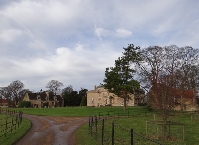
Fork in the road to the Hall
With Culverthorpe Hall and other park housing in the background, this view is of the private drive as it forks.
 Map © Crown Copyright")
TIP: Click the map for more Large scale mapping
- Grid Square
- TF0240, 21 images (more nearby 🔍)
- Photographer
- Debbie J (more nearby)
- Date Taken
- Sunday, 15 December, 2013 (more nearby)
- Submitted
- Tuesday, 17 December, 2013
- Subject Location
-
OSGB36:
 TF 0204 4033 [10m precision]
WGS84: 52:57.0394N 0:28.9616W - Camera Location
-
OSGB36: TF 0211 4031
- View Direction
- West-northwest (about 292 degrees)