2013
SN5880 : Aberystwyth rooftops
taken 11 years ago, near to Penparcau, Ceredigion/Sir Ceredigion, Wales
This is 1 of 2 images, with title Aberystwyth rooftops in this square
Aberystwyth rooftops
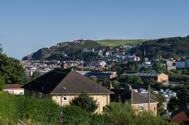
The rooftops of Aberystwyth, seen from Plas Helyg, off Penparcau Road. In the middle right of the photo is the new Vale of Rheidol Railway engine shed and in the far distance is Constitution Hill.
 Map © Crown Copyright")
TIP: Click the map for more Large scale mapping
- Grid Square
- SN5880, 228 images (more nearby 🔍)
- Photographer
- Ian Capper (more nearby)
- Date Taken
- Sunday, 25 August, 2013 (more nearby)
- Submitted
- Wednesday, 18 December, 2013
- Subject Location
-
OSGB36:
 SN 587 806 [100m precision]
WGS84: 52:24.3437N 4:4.6299W - Camera Location
-
OSGB36: SN 588 805
- View Direction
- NORTH (about 0 degrees)