2013
SN6080 : Llanbadarn Fawr
taken 11 years ago, near to Llanbadarn Fawr, Ceredigion/Sir Ceredigion, Wales
This is 1 of 6 images, with title Llanbadarn Fawr in this square
Llanbadarn Fawr
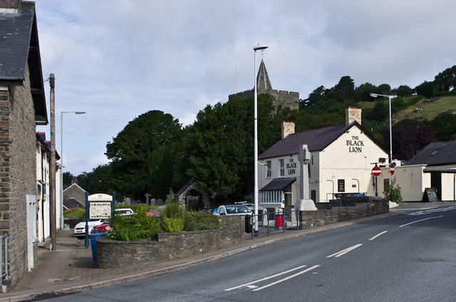
The square at Llanbadarn Fawr, with the war memorial and Black Lion pub on the right and St Padarn's Church behind.
 Map © Crown Copyright")
TIP: Click the map for more Large scale mapping
- Grid Square
- SN6080, 140 images (more nearby 🔍)
- Photographer
- Ian Capper (more nearby)
- Date Taken
- Saturday, 3 August, 2013 (more nearby)
- Submitted
- Sunday, 22 December, 2013
- Subject Location
-
OSGB36:
 SN 600 809 [100m precision]
WGS84: 52:24.4933N 4:3.5739W - Camera Location
-
OSGB36: SN 600 808
- View Direction
- West-northwest (about 292 degrees)