2013
SZ1195 : Throop: gate into floodwater
taken 10 years ago, near to Throop, Bournemouth, Christchurch & Poole, England
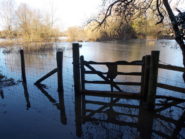
Throop: gate into floodwater
In fact, at normal levels the Stour is only a few feet in front of this gate, which allows access for anglers along the usual riverbank to the right. Nevertheless, this week's heavy rain has left us with an unusually flooded view of the Stour and its surroundings.
The public footpath hugs the side of the mill building, turning left here, and is still just about passable.
The public footpath hugs the side of the mill building, turning left here, and is still just about passable.
 Map © Crown Copyright")
TIP: Click the map for more Large scale mapping
- Grid Square
- SZ1195, 126 images (more nearby 🔍)
- Photographer
- Chris Downer (more nearby)
- Date Taken
- Thursday, 26 December, 2013 (more nearby)
- Submitted
- Saturday, 28 December, 2013
- Subject Location
-
OSGB36:
 SZ 1124 9578 [10m precision]
WGS84: 50:45.6903N 1:50.5202W - Camera Location
-
OSGB36: SZ 1124 9578
- View Direction
- Northeast (about 45 degrees)