2014
SZ1393 : Jan 2014: the flooded River Stour at the old Iford Bridge (3)
taken 10 years ago, near to Pokesdown, Bournemouth, Christchurch & Poole, England
Jan 2014: the flooded River Stour at the old Iford Bridge (3)
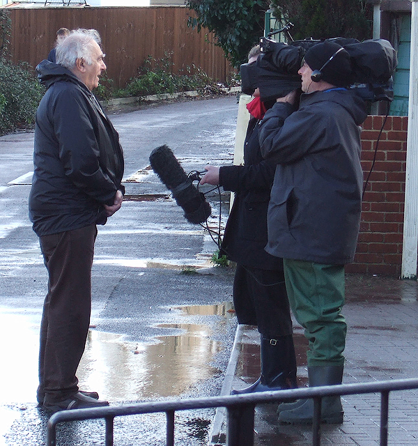
A local resident does a piece to camera for a national news report on the floods at Iford. The floods have attracted national television news teams that have reported on the evacuation of the unfortunate local residents of Iford Bridge Home Park for the second time since Christmas Day.
SZ1393 : Jan 2014: the flooded River Stour at the old Iford Bridge (4)
SZ1393 : Jan 2014: the flooded River Stour at the old Iford Bridge (4)
 Map © Crown Copyright")
TIP: Click the map for more Large scale mapping
- Grid Square
- SZ1393, 110 images (more nearby 🔍)
- Photographer
- Mike Searle (more nearby)
- Date Taken
- Friday, 3 January, 2014 (more nearby)
- Submitted
- Friday, 3 January, 2014
- Subject Location
-
OSGB36:
 SZ 1376 9350 [10m precision]
WGS84: 50:44.4569N 1:48.3815W - Camera Location
-
OSGB36: SZ 1375 9351
- View Direction
- East-southeast (about 112 degrees)