2014
SK4737 : Church of St Giles in Sandiacre
taken 10 years ago, near to Sandiacre, Derbyshire, England
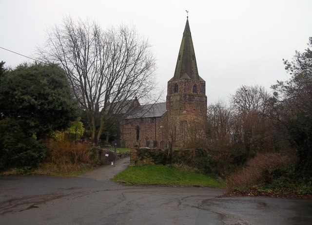
Church of St Giles in Sandiacre
Medieval church which occupies a commanding position overlooking the town and Erewash Valley. From a Geographing perspective this is a very varied gridsquare indeed, which in addition to the historic heart of Sandiacre contains the Triassic sandstone outcrop of Stony Clouds, a golf course and the M1 Motorway which cuts a swathe straight through the middle.
 Map © Crown Copyright")
TIP: Click the map for more Large scale mapping
- Grid Square
- SK4737, 47 images (more nearby 🔍)
- Photographer
- Jonathan Clitheroe (more nearby)
- Date Taken
- Saturday, 4 January, 2014 (more nearby)
- Submitted
- Sunday, 5 January, 2014
- Subject Location
-
OSGB36:
 SK 4796 3727 [10m precision]
WGS84: 52:55.8420N 1:17.2776W - Camera Location
-
OSGB36: SK 4793 3730
- View Direction
- East-southeast (about 112 degrees)