2014
NZ2556 : Bowes Railway Path at the Lamesley Reedbeds
taken 10 years ago, near to Kibblesworth, Gateshead, England
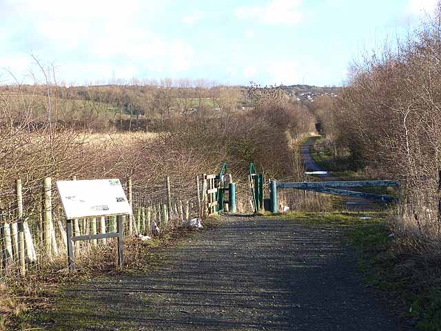
Bowes Railway Path at the Lamesley Reedbeds
Bowes Railway was originally a colliery railway built to carry coal from the pits at Dipton to the Tyne at Jarrow. The earliest section was designed by George Stephenson and opened on 17 January 1826, making it one of the world's first modern railways. The railway remained virtually intact until 1968. Between 1968 and 1974, most of the line was closed.
The path following the line of the railway has now been designated as Regional Route 11 of the National Cycle Network. The path sustained severe storm damage in 2012 and is due to be repaired and upgraded. The path is also designated as part of the Great North Forest Heritage Trail.
Here the path passes the Lamely Reedbeds, an innovative scheme where reedbeds are used to filter out both sewage and minewater pollutants before discharging into the River Team.
 Map © Crown Copyright")
TIP: Click the map for more Large scale mapping
- Grid Square
- NZ2556, 18 images (more nearby 🔍)
- Photographer
- Oliver Dixon (more nearby)
- Date Taken
- Wednesday, 8 January, 2014 (more nearby)
- Submitted
- Thursday, 9 January, 2014
- Subject Location
-
OSGB36:
 NZ 2567 5676 [10m precision]
WGS84: 54:54.2943N 1:36.0717W - Camera Location
-
OSGB36: NZ 2561 5674
- View Direction
- East-northeast (about 67 degrees)