2014
SD8621 : Stacksteads, Lee Quarry
taken 10 years ago, near to Britannia, Lancashire, England
This is 1 of 8 images, with title starting with St in this square
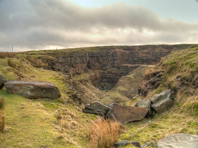
Stacksteads, Lee Quarry
Lee Quarry is a large gritstone quarry that has been disused since the 1970s. On 21 April 1999, planning permission was granted for the partial reclamation of the quarry for public amenity. The site is now well used by walkers and mountain bikers and includes pedestrian and mountain bike circulation routes and interpretation display boards.
The eastern part of Lee Quarry has the best industrial archaeology remains of all the large Haslingden Flag quarries in Rossendale. The eastern section was worked by many companies from ca1820 until 1955 using traditional techniques. What is seen today are the dramatic deep open pits as abandoned suddenly in 1955 with no re-quarrying. Because of the enormous amount of exposed rock, the site is a Geological Site of Special Scientific Interest.
The eastern part of Lee Quarry has the best industrial archaeology remains of all the large Haslingden Flag quarries in Rossendale. The eastern section was worked by many companies from ca1820 until 1955 using traditional techniques. What is seen today are the dramatic deep open pits as abandoned suddenly in 1955 with no re-quarrying. Because of the enormous amount of exposed rock, the site is a Geological Site of Special Scientific Interest.
 Map © Crown Copyright")
TIP: Click the map for more Large scale mapping
- Grid Square
- SD8621, 118 images (more nearby 🔍)
- Photographer
- David Dixon (more nearby)
- Date Taken
- Monday, 13 January, 2014 (more nearby)
- Submitted
- Monday, 13 January, 2014
- Subject Location
-
OSGB36:
 SD 8685 2114 [10m precision]
WGS84: 53:41.1927N 2:12.0354W - Camera Location
-
OSGB36: SD 86850 21141
- View Direction
- Northeast (about 45 degrees)