2014
SK6328 : The Old School House, Widmerpool
taken 10 years ago, near to Widmerpool, Nottinghamshire, England
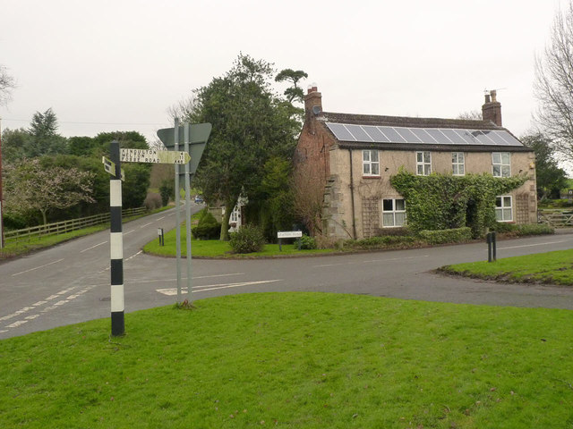
The Old School House, Widmerpool
Marked as school on the earliest 1:2500 maps, prior to the building of a standard school at the junction of Main Street and Wysall Lane.
There is a bench mark Link on the right-hand quoin of the building.
The fingerpost is a standard Nottinghamshire County Council square concrete post.
There is a bench mark Link on the right-hand quoin of the building.
The fingerpost is a standard Nottinghamshire County Council square concrete post.
 Map © Crown Copyright")
TIP: Click the map for more Large scale mapping
- Grid Square
- SK6328, 28 images (more nearby 🔍)
- Photographer
- Alan Murray-Rust (more nearby)
- Date Taken
- Friday, 24 January, 2014 (more nearby)
- Submitted
- Monday, 27 January, 2014
- Subject Location
-
OSGB36:
 SK 6325 2822 [10m precision]
WGS84: 52:50.8667N 1:3.7369W - Camera Location
-
OSGB36: SK 6324 2820
- View Direction
- NORTH (about 0 degrees)