2014
NS4312 : Dunston Hill opencast mine
taken 10 years ago, near to Knockshinnoch, East Ayrshire, Scotland
This is 1 of 2 images, with title Dunston Hill opencast mine in this square
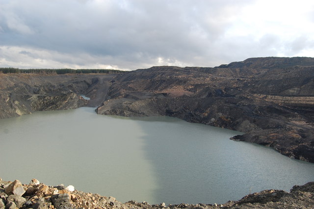
Dunston Hill opencast mine
This is the massive flooded hole left by opencast coal mining, spoil heap in the distance.
 Map © Crown Copyright")
TIP: Click the map for more Large scale mapping
- Grid Square
- NS4312, 12 images (more nearby 🔍)
- Photographer
- Scott (more nearby)
- Date Taken
- Wednesday, 29 January, 2014 (more nearby)
- Submitted
- Wednesday, 29 January, 2014
- Subject Location
-
OSGB36:
 NS 4357 1251 [10m precision]
WGS84: 55:22.8934N 4:28.2392W - Camera Location
-
OSGB36: NS 4335 1241
- View Direction
- East-northeast (about 67 degrees)