2014
NZ5101 : Whorlton Moor
taken 10 years ago, near to Faceby, North Yorkshire, England
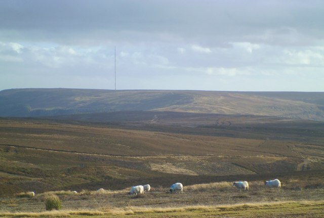
Whorlton Moor
The view is across the upper reaches of Thackdale, which is also known as Snotterdale. Whorlton Moor may not seem a particularly appropriate name for this area, but it is the moorland within the parish of Whorlton, a once thriving village now reduced to a small number of farms and houses at the base of the escarpment.
 Map © Crown Copyright")
TIP: Click the map for more Large scale mapping
- Grid Square
- NZ5101, 20 images (more nearby 🔍)
- Photographer
- Gordon Hatton (more nearby)
- Date Taken
- Sunday, 2 February, 2014 (more nearby)
- Submitted
- Monday, 3 February, 2014
- Subject Location
-
OSGB36:
 NZ 5167 0160 [10m precision]
WGS84: 54:24.4346N 1:12.3284W - Camera Location
-
OSGB36: NZ 5155 0177
- View Direction
- South-southeast (about 157 degrees)