2006
NT9820 : Dod Hill
taken 18 years ago, 3 km from South Middleton, Northumberland, England
This is 1 of 2 images, with title Dod Hill in this square
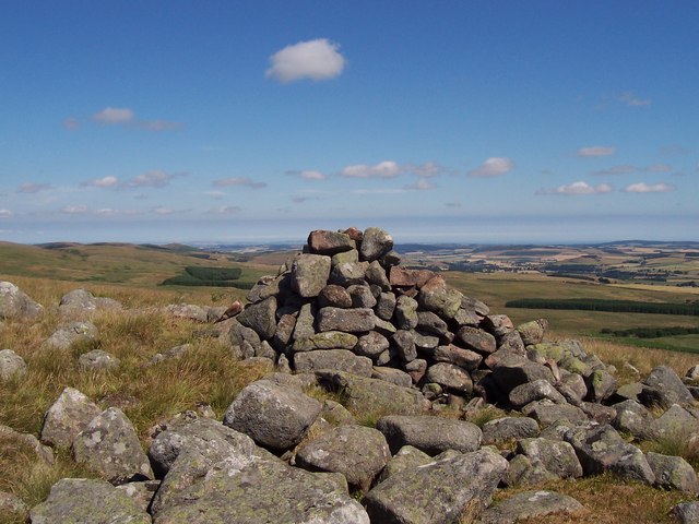
Dod Hill
The summit cairn of Dod Hill looking towards a distant North Sea coast. For free detailed walking routes in the area visit Link
 Map © Crown Copyright")
TIP: Click the map for more Large scale mapping
- Grid Square
- NT9820, 14 images (more nearby 🔍)
- Photographer
- Geoff Holland (more nearby)
- Date Taken
- Tuesday, 18 July, 2006 (more nearby)
- Submitted
- Sunday, 1 April, 2007
- Subject Location
-
OSGB36:
 NT 987 208 [100m precision]
WGS84: 55:28.8931N 2:1.2610W - Camera Location
-
OSGB36: NT 987 207
- View Direction
- Northeast (about 45 degrees)