2004
NH5126 : John Cobb measured mile
taken 20 years ago, near to Lenie, Highland, Scotland
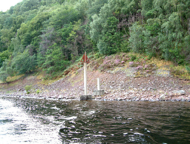
John Cobb measured mile
One of four markers on Loch Ness, indicating the start and finish of the measured mile on either shore, used during John Cobb's fatal attempt to beat the world water speed record on the 29th of September, 1952. Cobb was travelling as much as 206mph, when his boat nose-dived and disintegrated, killing him instantly.
 Map © Crown Copyright")
TIP: Click the map for more Large scale mapping
- Grid Square
- NH5126, 20 images (more nearby 🔍)
- Photographer
- Richard Haworth (more nearby)
- Date Taken
- Saturday, 28 August, 2004 (more nearby)
- Submitted
- Tuesday, 16 August, 2005
- Subject Location
-
OSGB36:
 NH 51 26 [1000m precision]
WGS84: 57:18.2910N 4:27.9964W