2014
SE0724 : Wainhouse Tower taken from Scarr Bottom Road near to the junction with Masters Lane
taken 10 years ago, near to Halifax, Calderdale, England
This is 1 of 12 images, with title starting with Wainhouse in this square
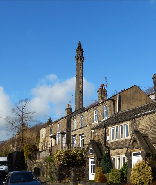
Wainhouse Tower taken from Scarr Bottom Road near to the junction with Masters Lane
Wainhouse Tower, built by John Edward Wainhouse, was conceived as a mill chimney for his Dye Works, on what is now the Washer Lane Industrial Estate. Hoever he sold the Works, before the tower was completed, and it is now the world's tallest folly.
 Map © Crown Copyright")
TIP: Click the map for more Large scale mapping
- Grid Square
- SE0724, 410 images (more nearby 🔍)
- Photographer
- Michael Steele (more nearby)
- Date Taken
- Sunday, 2 February, 2014 (more nearby)
- Submitted
- Sunday, 9 February, 2014
- Subject Location
-
OSGB36:
 SE 078 240 [100m precision]
WGS84: 53:42.7418N 1:52.9708W - Camera Location
-
OSGB36: SE 078 238
- View Direction
- NORTH (about 0 degrees)