2013
NF8535 : Storehouse for Uisinish Lighthouse
taken 11 years ago, 5 km SE of Lochskipport, South Uist & Benbecula, Na h-Eileanan an Iar, Scotland
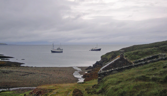
Storehouse for Uisinish Lighthouse
A view of Uisinish Bay. In the foreground is the storehouse above the derelict jetty once used to land supplies for the lighthouse.
 Map © Crown Copyright")
TIP: Click the map for more Large scale mapping
- Grid Square
- NF8535, 2 images (more nearby 🔍)
- Photographer
- Marc Calhoun (more nearby)
- Date Taken
- Tuesday, 13 August, 2013 (more nearby)
- Submitted
- Sunday, 9 February, 2014
- Subject Location
-
OSGB36:
 NF 857 354 [100m precision]
WGS84: 57:18.0356N 7:13.2182W - Camera Location
-
OSGB36: NF 857 353
- View Direction
- North-northeast (about 22 degrees)