2007
SO8453 : Blue Boat Diglis basin
taken 17 years ago, near to St Johns, Worcestershire, England
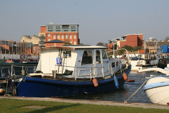
Blue Boat Diglis basin.
Looking up the line of the Birmingham & Worcester canal which goes between the converted flour mill on the left and the new apartments (with sloping curved roof-line) on the right. A bright and bustling Sunday afternoon.
 Map © Crown Copyright")
TIP: Click the map for more Large scale mapping
- Grid Square
- SO8453, 467 images (more nearby 🔍)
- Photographer
- Chris Allen (more nearby)
- Date Taken
- Sunday, 1 April, 2007 (more nearby)
- Submitted
- Sunday, 1 April, 2007
- Subject Location
-
OSGB36:
 SO 849 538 [100m precision]
WGS84: 52:10.9669N 2:13.2833W - Camera Location
-
OSGB36: SO 849 538
- View Direction
- Northeast (about 45 degrees)