2014
TM2991 : Moss-covered Banham's Lane
taken 10 years ago, 3 km from Woodton, Norfolk, England
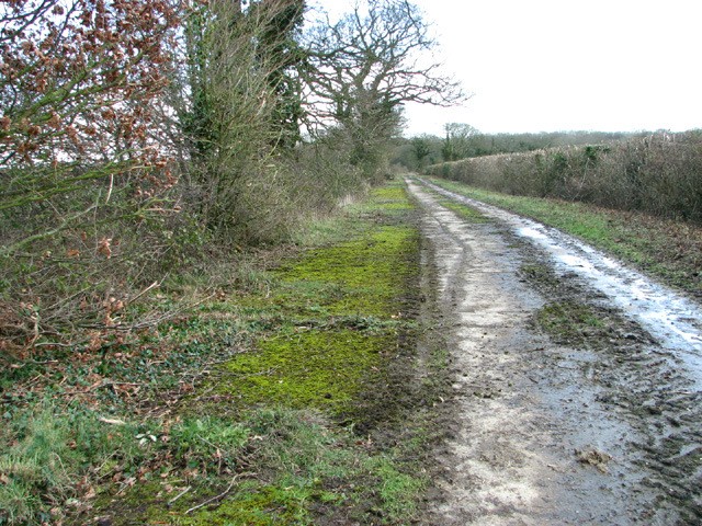
Moss-covered Banham's Lane
During WW2, a large area in the vicinity of Earsham Hall was used as a bomb store by the United States Army Air Force, known as the Earsham Forward Ammunition Depot, Station 545. Bombs were stored in a number of woods, including Sexton Wood, and also beside several of the roads in the area, including Hall Road, Denton Road, Pheasants Walk, Five Acre Lane, Banham's Lane and quite a few more, and on the hardstandings beside this concreted track. Earsham Hall was the headquarters and the camp was situated in the grounds. Bombs were brought there by railway > Link and then transported on lorries to airfields all over East Anglia.
 Map © Crown Copyright")
TIP: Click the map for more Large scale mapping
- Grid Square
- TM2991, 43 images (more nearby 🔍)
- Photographer
- Evelyn Simak (more nearby)
- Date Taken
- Thursday, 13 February, 2014 (more nearby)
- Submitted
- Thursday, 13 February, 2014
- Subject Location
-
OSGB36:
 TM 2920 9127 [10m precision]
WGS84: 52:28.2728N 1:22.3899E - Camera Location
-
OSGB36: TM 2912 9124
- View Direction
- East-northeast (about 67 degrees)