SO8660 : Lock No 7 north of Fernhill Heath, Worcestershire
taken 11 years ago, near to Salwarpe, Worcestershire, England
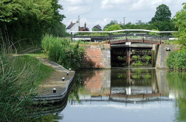
(before the canal restoration this was listed as Lock No 2)
The Droitwich Barge Canal from Hawford to Droitwich was opened in 1771 having taken four years to build. James Brindley was the designer and Robert Whitworth the resident engineer (Brindley was busy elsewhere much of the time). The canal needed to accommodate the Severn fourteen foot beam river barges (called trows), so locks and bridges are wide. This became a very busy canal, but its eventual decline was inevitable because of increasing railway competition, and the last boat used the canal in 1918. A trust was formed in 1973, aiming to restore and reopen the canal. This eventually happened in 2010.
The Droitwich Junction Canal was built in 1854 to link Droitwich (and the Barge Canal) to the main canal system at Hanbury, where the Worcester and Birmingham Canal is joined. This canal accommodates narrowboats (seven foot beam) only. The canal closed in the mid 1920s, then was restored and partly rebuilt, and opened in 2011.
Information summarised from the Droitwich Canals Trust site: Link
 Map © Crown Copyright")
- Grid Square
- SO8660, 152 images (more nearby 🔍)
- Photographer
- Roger D Kidd (more nearby)
- Date Taken
- Friday, 21 June, 2013 (more nearby)
- Submitted
- Monday, 3 March, 2014
- Subject Location
-
OSGB36:
 SO 86698 60841 [1m precision]
WGS84: 52:14.7353N 2:11.7748W - Camera Location
-
OSGB36: SO 86670 60805
- View Direction
- Northeast (about 45 degrees)