2007
TF4143 : Saltmarsh at Freiston Shore
taken 17 years ago, near to Freiston Shore, Lincolnshire, England
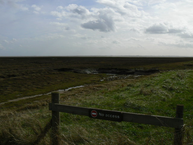
Saltmarsh at Freiston Shore
A view of the natural saltmarsh, taken from the seawall of the Freiston Shore managed realignment site.
 Map © Crown Copyright")
TIP: Click the map for more Large scale mapping
- Grid Square
- TF4143, 31 images (more nearby 🔍)
- Photographer
- Dan Friess (more nearby)
- Date Taken
- Monday, 5 March, 2007 (more nearby)
- Submitted
- Thursday, 5 April, 2007
- Subject Location
-
OSGB36:
 TF 413 431 [100m precision]
WGS84: 52:58.0193N 0:6.2216E - Camera Location
-
OSGB36: TF 411 434
- View Direction
- Southeast (about 135 degrees)