2013

TQ3377 : Sunday barbecues overlooking the lake, Burgess Park

taken 13 years ago, near to Camberwell, Southwark, England
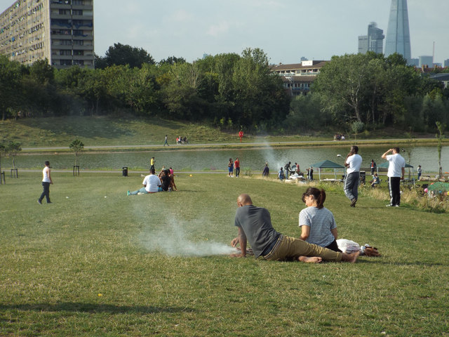
Sunday barbecues overlooking the lake, Burgess Park
Fine weather. Bank Holiday weekend. Music, chatter, smoke and delicious smells in the air.

Creative Commons Licence [Some Rights Reserved]   © Copyright Robin Stott and licensed for reuse under this Creative Commons Licence.
Burgess Park (provided by Malc McDonald)

Burgess Park, in inner South East London, is unusual as it is a large park created on a "brownfield" site.

The area was previously occupied by streets, houses and light industry as well as a branch of the Surrey Canal. Plans to create a park here started in the 1940s. At the time, there was very little green open space in this part of inner city London.

The park gradually grew, but in rather haphazard fashion with decaying, abandoned roads still cutting into the park. In 2011-2012 the park closed for about a year so that major work could be done to regenerate the park.

Geographical Context: Park and Public Gardens Suburb, Urban fringe People, Events Flat landscapes Place: London Peckham Burgess Park Postcode Area: SE5 other tags: Picnic Barbecue Click a tag, to view other nearby images.
This photo is linked from: Automatic Clusters: · Lake in Burgess Park [20] ·
1:50,000 Modern Day Landranger(TM) Map © Crown Copyright
+
+
1:50,000 Modern Day Landranger(TM) Map © Crown Copyright
TIP: Click the map for more Large scale mapping
Grid Square
TQ3377, 345 images   (more nearby 🔍)
Photographer
Robin Stott   (more nearby)
Date Taken
Sunday, 25 August, 2013   (more nearby)
Submitted
Monday, 24 March, 2014
Subject Location
OSGB36: geotagged! TQ 3338 7783 [10m precision]
WGS84: 51:29.0222N 0:4.8302W
Camera Location
OSGB36: geotagged! TQ 3339 7780
View Direction
North-northwest (about 337 degrees)
Clickable map
+
NW N NE
W Go E
SW S SE
Image classification(about): Geograph
This page has been viewed about 639 times