2014
ST5069 : Farmer's bridge
taken 10 years ago, near to Flax Bourton, North Somerset, England
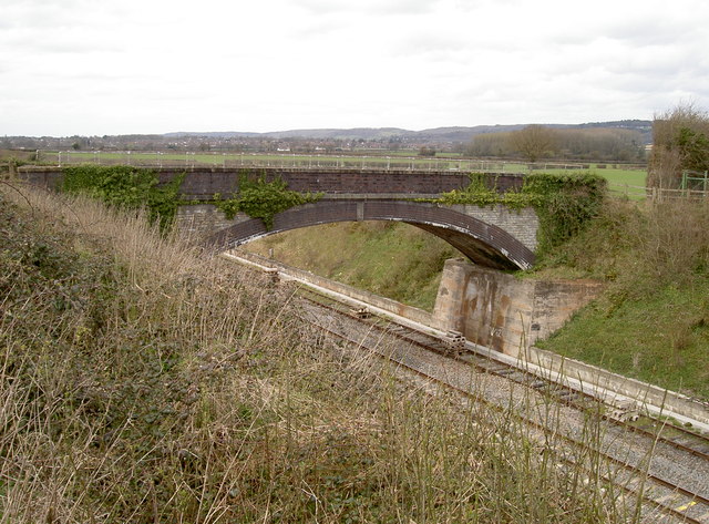
Farmer's bridge
This crossing of the main south-west railway line is for the benefit of the local landowners, chiefly Priory Farm. See ST5069 : Bridge for wellies for the reason why it's an agricultural bridge.
 Map © Crown Copyright")
TIP: Click the map for more Large scale mapping
- Grid Square
- ST5069, 89 images (more nearby 🔍)
- Photographer
- Neil Owen (more nearby)
- Date Taken
- Monday, 24 March, 2014 (more nearby)
- Submitted
- Monday, 24 March, 2014
- Subject Location
-
OSGB36:
 ST 5052 6975 [10m precision]
WGS84: 51:25.4752N 2:42.7822W - Camera Location
-
OSGB36: ST 5057 6974
- View Direction
- West-northwest (about 292 degrees)