2014
NM7734 : Lady's Rock and the Isle of Mull
taken 10 years ago, 3 km from Kilpatrick, Isle of Mull, Argyll And Bute, Scotland
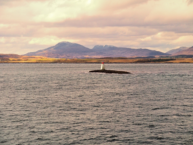
Lady's Rock and the Isle of Mull
Lady's Rock is a skerry to the south west of Lismore in the Inner Hebrides. It is submerged at high tide and carries a navigation beacon. NM7735 : Lismore Lighthouse on Eilean Musdile is to the north east, next to Lismore.
This view is from the Oban to Craignure ferry.
This view is from the Oban to Craignure ferry.
 Map © Crown Copyright")
TIP: Click the map for more Large scale mapping
- Grid Square
- NM7734, 50 images (more nearby 🔍)
- Photographer
- David Dixon (more nearby)
- Date Taken
- Thursday, 27 March, 2014 (more nearby)
- Submitted
- Monday, 31 March, 2014
- Subject Location
-
OSGB36:
 NM 772 343 [100m precision]
WGS84: 56:26.9220N 5:36.9965W - Camera Location
-
OSGB36: NM 779 345
- View Direction
- West-southwest (about 247 degrees)