2014
SU5885 : Floods at the Bridge
taken 10 years ago, near to Cholsey, Oxfordshire, England
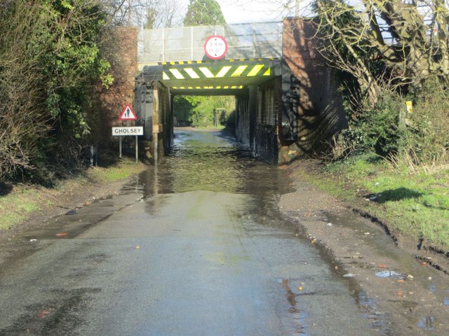
Floods at the Bridge
Not the best way to get into Cholsey but a matter of having to with a lot of water under Dead Mans bridge. Really like to know how Network rail got the name from
 Map © Crown Copyright")
TIP: Click the map for more Large scale mapping
- Grid Square
- SU5885, 344 images (more nearby 🔍)
- Photographer
- Bill Nicholls (more nearby)
- Date Taken
- Friday, 7 February, 2014 (more nearby)
- Submitted
- Monday, 7 April, 2014
- Subject Location
-
OSGB36:
 SU 5847 8592 [10m precision]
WGS84: 51:34.1477N 1:9.4670W - Camera Location
-
OSGB36: SU 5846 8590
- View Direction
- Northeast (about 45 degrees)