2007
SP3279 : Coventry fire station
taken 17 years ago, near to Coventry, England
This is 1 of 67 images, with title starting with Coventry in this square
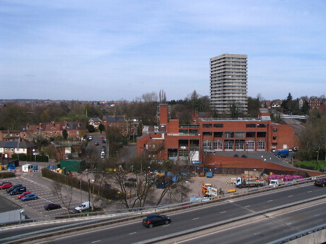
Coventry fire station
This station took over from the old fire station in Hales Street ( SP3379 : The old fire station ) in 1976. To its left are houses in Middleborough Road, Abbots Lane and Mill Street; to the right, Radford Radial spur. The tower block is Naul's Mill House, the nearby trees are in Naul's Mill Park and the dual carriageway is part of the inner ring road.
 Map © Crown Copyright")
TIP: Click the map for more Large scale mapping
- Grid Square
- SP3279, 397 images (more nearby 🔍)
- Photographer
- E Gammie (more nearby)
- Date Taken
- Friday, 6 April, 2007 (more nearby)
- Submitted
- Saturday, 7 April, 2007
- Subject Location
-
OSGB36:
 SP 329 794 [100m precision]
WGS84: 52:24.7292N 1:31.0030W - Camera Location
-
OSGB36: SP 329 792
- View Direction
- NORTH (about 0 degrees)