TQ2785 : At the north end of Upper Park Road, Belsize Park
taken 10 years ago, near to Hampstead, Camden, England
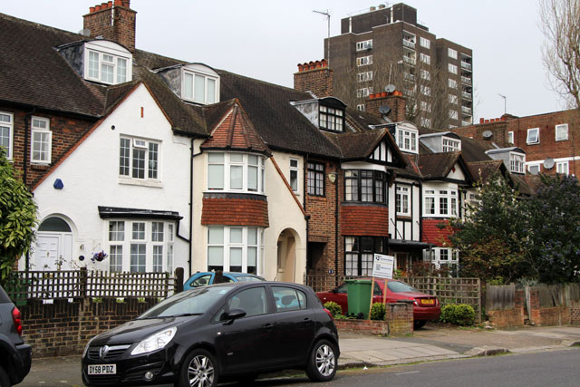
The extensive Belsize estate, with its frontage on both sides of Haverstock Hill, was an early magnet for merchants and others who wanted a country house within easy reach of London. From the 16th century onwards there was a steady programme of building, demolition and rebuilding right up to the early 19th century when, in 1808, the Belsize estate was split into nine leasehold estates, focussed on single houses. Until the late 1840s and early 1850s the area remained rural; country houses set in parkland with associated cottages and farm buildings. The middle of the century, however, saw a boom in building and speculation with 99 year building leases granted for all the nine estates and by 1880 Belsize Park, stretching from Hampstead in the north to Clapham in the south was virtually built up, socially homogeneous, with mainly detached and semi-detached houses in a classical or Italianate style, broken only by small groups of mews.
This description is based on a detailed article available in British History Online Link
William Lund, lessee of the estate to the east of Haverstock Hill, secured a 99-year building lease in 1852. Setting aside around 8 acres around his home, Haverstock Lodge, Lund planned an estate called St. John's Park on the other 38 acres. His scheme was for parallel curving roads from Haverstock Hill to his boundary at the River Fleet, linked by four cross roads. There were to be around 280 buildings, consisting of 133 semi-detached villas and terraces, shops, and mews on the low-lying land by the river. Building began from the Haverstock Hill end and by 1862 Park Road (now Parkhill Road) and Fleet Road, as yet unnamed, were laid out, together with the south-western half of Lawn Road and Upper Park Road. About 60 substantial and 'unobtrusively classical' houses had been built on those roads and fronting Haverstock Hill, mainly by Richard Batterbury of Camden Town, the chief speculative builder. Church Road (now Tasker Road) and Lower Cross Road (now Garnett Road) had been laid out by 1862 but no houses built. Residents were described in a guidebook of the 1860s on Haverstock Hill as 'City men such as stockbrokers, merchants, and commercial agents'.
Lund's plans for the northern part of the Haverstock Lodge estate were doomed from the start, partly because the river Fleet's unsavoury condition prevented the establishment of a middle-class shopping quarter, and partly because of refusals to build above the St. Pancras tunnel extension of the Midland railway. The final blight was the opening in 1870 of a smallpox hospital on the site of the present Royal Free Hospital, backing onto Lawn Road. Building virtually stopped until 30 houses and 12 stables were built between 1879 and 1885 in Park, Upper Park, and Lawn roads. By that date, although the district from Haverstock Hill north to just beyond Church (Tasker) Road, was 'well-to-do, middleclass', the area to the north consisted of modern roads occupied by 'decent artisans', large tram stables at South End, and streets near Fleet Road housing transport workers and labourers. The social status of the estate had started to decline and in 1893 a resident of Upper Park Road recorded the tenementation of houses at the north end of the street to 'objectionable people'.
 Map © Crown Copyright")
- Grid Square
- TQ2785, 607 images (more nearby 🔍)
- Photographer
- Kate Jewell (more nearby)
- Date Taken
- Monday, 31 March, 2014 (more nearby)
- Submitted
- Tuesday, 8 April, 2014
- Subject Location
-
OSGB36:
 TQ 2760 8528 [10m precision]
WGS84: 51:33.1193N 0:9.6602W - Camera Location
-
OSGB36: TQ 2762 8526
- View Direction
- Northwest (about 315 degrees)