2012
SO3104 : Dominant oak, Croes y Pant Lane
taken 12 years ago, near to Croes y Pant, Monmouthshire/Sir Fynwy, Wales
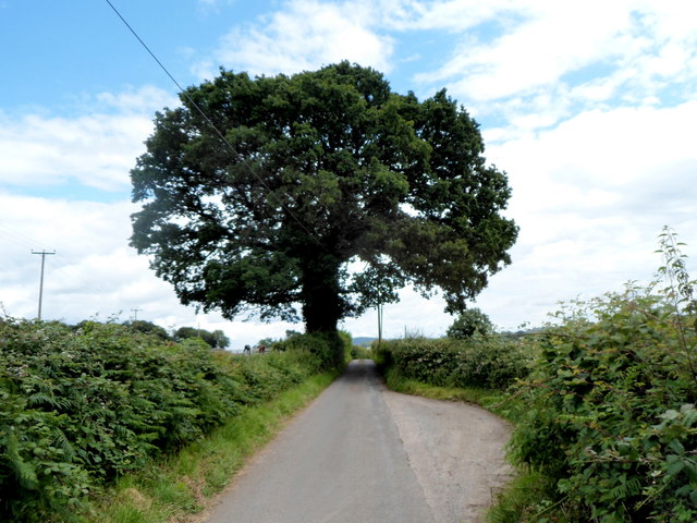
Dominant oak, Croes y Pant Lane
A satellite view of the top of the tree allows an estimate of its width to be made. The distance across the top of the roughly circular canopy is between 20 and 25 metres.
There is a passing place on the right (southeast) side of the narrow lane.
There is a passing place on the right (southeast) side of the narrow lane.
 Map © Crown Copyright")
TIP: Click the map for more Large scale mapping
- Grid Square
- SO3104, 68 images (more nearby 🔍)
- Photographer
- Jaggery (more nearby)
- Date Taken
- Friday, 20 July, 2012 (more nearby)
- Submitted
- Wednesday, 9 April, 2014
- Subject Location
-
OSGB36:
 SO 3180 0420 [10m precision]
WGS84: 51:43.9407N 2:59.3365W - Camera Location
-
OSGB36: SO 3183 0422
- View Direction
- West-southwest (about 247 degrees)