2004
NH5229 : The Rivermouth, Urquhart Bay, Loch Ness
taken 20 years ago, near to Strone, Highland, Scotland
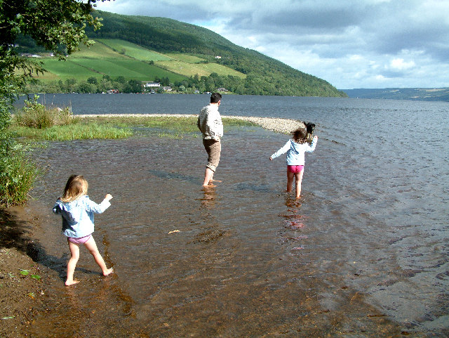
The Rivermouth, Urquhart Bay, Loch Ness
Looking east from the mouth of the Coiltie, which meanders through a 46 hectare Alder swamp. Reached via an easy path that starts between the graveyard and the waterworks. The path winds its way for about 1km through this rare, alluvial twin delta, the confluence of the Rivers Enrick and Coiltie as they flow into Loch Ness. People have been lost for many hours in this dense, boggy area, so it's advisable not to stray from the paths! Designated as a Site of Special Scientific Interest (SSSI) and an Ancient Woodland Site (AWS). It has also been proposed as a Special Area of Conservation (SAC).
 Map © Crown Copyright")
TIP: Click the map for more Large scale mapping
- Grid Square
- NH5229, 36 images (more nearby 🔍)
- Photographer
- Richard Haworth (more nearby)
- Date Taken
- Wednesday, 25 August, 2004 (more nearby)
- Submitted
- Thursday, 18 August, 2005
- Subject Location
-
OSGB36:
 NH 52 29 [1000m precision]
WGS84: 57:19.9258N 4:27.1090W