2014
NN3440 : Path on the flank of Beinn Achaladair
taken 10 years ago, 4 km SE of Achallader, Argyll And Bute, Scotland
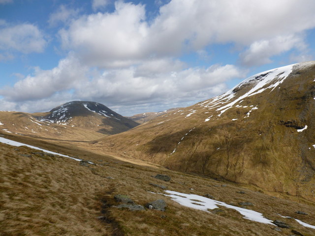
Path on the flank of Beinn Achaladair
This path provides a route towards Beinn Mhanach from the head of Coire Daingean.
 Map © Crown Copyright")
TIP: Click the map for more Large scale mapping
- Grid Square
- NN3440, 16 images (more nearby 🔍)
- Photographer
- Alan O'Dowd (more nearby)
- Date Taken
- Monday, 14 April, 2014 (more nearby)
- Submitted
- Wednesday, 16 April, 2014
- Subject Location
-
OSGB36:
 NN 346 407 [100m precision]
WGS84: 56:31.7972N 4:41.4206W - Camera Location
-
OSGB36: NN 345 407
- View Direction
- Northeast (about 45 degrees)