2014
SD5187 : 1GL Bolt: Sedgwick Viaduct
taken 10 years ago, near to Sedgwick, Cumbria, England
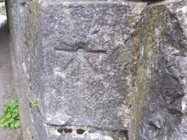
1GL Bolt: Sedgwick Viaduct
This bench mark was used during the First primary levelling, England & Wales, and was levelled with a height of 126.9150 feet [38.6837 metres] above mean sea level (Liverpool datum). It was included on the Liverpool to Port Carlisle levelling line. The surveyor's description was No. 271. Bolt in South face and towing-path side of Sedgwick Viaduct ; 4.15 ft. above surface (p417).
For more on this bench mark, click here: Link
For more on this bench mark, click here: Link
 Map © Crown Copyright")
TIP: Click the map for more Large scale mapping
- Grid Square
- SD5187, 44 images (more nearby 🔍)
- Photographer
- Tony Houlihan (more nearby)
- Date Taken
- Friday, 25 April, 2014 (more nearby)
- Submitted
- Friday, 25 April, 2014
- Subject Location
-
OSGB36:
 SD 5133 8702 [10m precision]
WGS84: 54:16.5897N 2:44.9364W - Camera Location
-
OSGB36: SD 5133 8702
- View Direction
- East-northeast (about 67 degrees)