2006
NS8183 : Anchor Burn, Dunipace
taken 18 years ago, near to Dunipace, Falkirk, Scotland
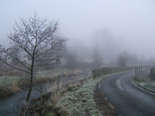
Anchor Burn, Dunipace
The Anchor Burn and minor road beyond the foot of Milton Row, on a very cold January morning.
 Map © Crown Copyright")
TIP: Click the map for more Large scale mapping
- Grid Square
- NS8183, 28 images (more nearby 🔍)
- Photographer
- David Neill (more nearby)
- Date Taken
- Wednesday, 4 January, 2006 (more nearby)
- Submitted
- Wednesday, 11 April, 2007
- Subject Location
-
OSGB36:
 NS 811 834 [100m precision]
WGS84: 56:1.7217N 3:54.5701W - Camera Location
-
OSGB36: NS 810 834
- View Direction
- East-northeast (about 67 degrees)