2014
SX8767 : New road, Kingskerswell
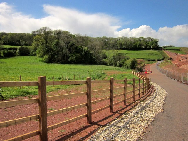
taken 10 years ago, near to Kingskerswell, Devon, England
This is 1 of 4 images, with title New road, Kingskerswell in this square
New road, Kingskerswell
Not the link road itself, which is being prepared on the right, but a replacement for Churchway Lane and the John Musgrave Heritage Trail, blocked by the roadworks - see SX8767 : Blocked lane, Kingskerswell. On the horizon is the truncated access woodland on Kerswell Down Hill, which the new road carves through. On the left, nearer at hand, is Snakey Copse, owned by the Woodland Trust and now horribly adjacent to piles of debris by the new roads.
 Map © Crown Copyright")
TIP: Click the map for more Large scale mapping
- Grid Square
- SX8767, 312 images (more nearby 🔍)
- Photographer
- Derek Harper (more nearby)
- Date Taken
- Sunday, 11 May, 2014 (more nearby)
- Submitted
- Thursday, 15 May, 2014
- Subject Location
-
OSGB36:
 SX 8750 6742 [10m precision]
WGS84: 50:29.7449N 3:35.2486W - Camera Location
-
OSGB36: SX 8757 6736
- View Direction
- Northwest (about 315 degrees)