2004
SY8080 : Man o' War Cove, West Lulworth
taken 19 years ago, near to West Lulworth, Dorset, England
This is 1 of 2 images, with title Man o' War Cove, West Lulworth in this square
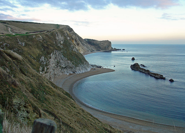
Man o' War Cove, West Lulworth
Man o' War Rocks are the eastward extension of the near-vertical Portland Stone bed that makes up Durdle Door. Further on, the bed forms the vertical face of Dungy Head, and the cliffs that hem in Lulworth Cove. The coves, and the eroded area behind Dungy Head, consist of soft Wealden beds, while the main cliff-line is formed by relatively hard Upper Greensand, oxidised to orange above St Oswald's Bay. Behind this is chalk downland.
 Map © Crown Copyright")
TIP: Click the map for more Large scale mapping
- Grid Square
- SY8080, 415 images (more nearby 🔍)
- Photographer
- Dylan Moore (more nearby)
- Date Taken
- Monday, 29 November, 2004 (more nearby)
- Submitted
- Monday, 19 May, 2014
- Subject Location
-
OSGB36:
 SY 80748 80268 [1m precision]
WGS84: 50:37.3077N 2:16.4106W - Camera Location
-
OSGB36: SY 80614 80317
- View Direction
- East-southeast (about 112 degrees)