2014
NS8067 : Wasteland near Caldercruix
taken 10 years ago, near to Caldercruix, North Lanarkshire, Scotland
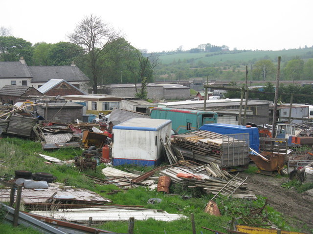
Wasteland near Caldercruix
Or a stud farm according to the notice on the gate. The Bathgate-Airdrie railway is in the distance.
 Map © Crown Copyright")
TIP: Click the map for more Large scale mapping
- Grid Square
- NS8067, 52 images (more nearby 🔍)
- Photographer
- M J Richardson (more nearby)
- Date Taken
- Monday, 19 May, 2014 (more nearby)
- Submitted
- Tuesday, 20 May, 2014
- Subject Location
-
OSGB36:
 NS 8094 6763 [10m precision]
WGS84: 55:53.2227N 3:54.3058W - Camera Location
-
OSGB36: NS 8100 6758
- View Direction
- Northwest (about 315 degrees)