2007
ST7475 : Frying Pan Pond, Dyrham Park
taken 17 years ago, near to Dyrham, South Gloucestershire, England
This is 1 of 3 images, with title Frying Pan Pond, Dyrham Park in this square
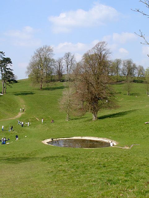
Frying Pan Pond, Dyrham Park
This pond first appeared on the 1833 estate map. It has been used as a drinking pool for livestock.
 Map © Crown Copyright")
TIP: Click the map for more Large scale mapping
- Grid Square
- ST7475, 330 images (more nearby 🔍)
- Photographer
- Linda Bailey (more nearby)
- Date Taken
- Monday, 9 April, 2007 (more nearby)
- Submitted
- Friday, 13 April, 2007
- Subject Location
-
OSGB36:
 ST 7451 7580 [10m precision]
WGS84: 51:28.8346N 2:22.1069W - Camera Location
-
OSGB36: ST 7456 7574
- View Direction
- Northwest (about 315 degrees)