2014
NS5479 : Start of a path through the Squirrel Wood
taken 10 years ago, near to Netherton, Stirling, Scotland
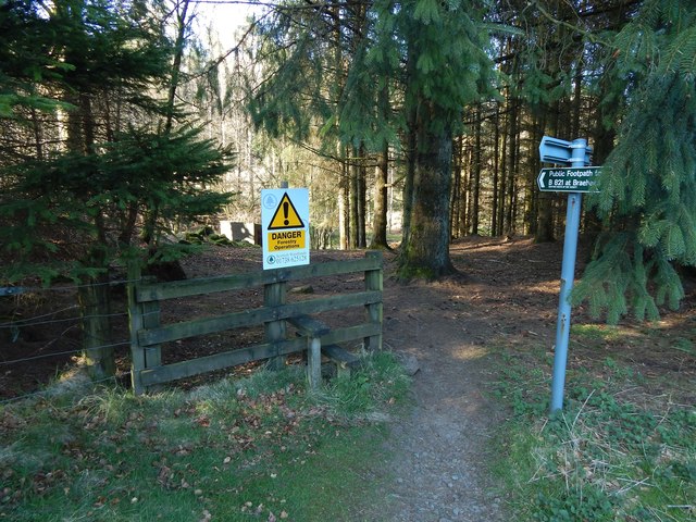
Start of a path through the Squirrel Wood
The area ahead is known as the Squirrel Wood, though that name does not appear on OS maps. The path is signposted as a "Public Footpath to B821 at Braehead". It branches off at this point from the Boards Farm Road, or Gowk Stane Road Link now part of the John Muir Way.
See NS5479 : Leaving the Squirrel Wood for a view of the fence and stile from the other side.
For some views from further along the public footpath, see NS5479 : Paths in the Squirrel Wood, taken about halfway through the woods, and NS5479 : The end of a path and NS5479 : The start of a path, which show the point where it ends, at the B821.
Large-scale OS mapping shows that the Squirrel Wood contains several named crags; one of them, the NS5479 : Pillar Craig, was described by J G Smith as follows: "the south side of the strath has also its rocky cliffs and wooded terraces and fine basaltic columns, particularly at the Pillar Craig on the Craigallian estate" ["Parish of Strathblane" (1886), page 3].
Outcrops I had passed just a few minutes earlier on this walk had much the same appearance: NS5479 : Igneous outcrops beside forestry track and NS5478 : Forestry track.
Other examples can be found in the Squirrel Wood itself: by far the most impressive is the already-mentioned NS5479 : Pillar Craig, but it is located some way off the public footpath. Two more modest examples can be seen near the footpath: NS5479 : Craigbrock and NS5479 : Cat Craig.
See also NS5479 : Path through the Squirrel Wood, from a little further ahead.
The writer J G Smith, quoted above, links place-names in this area with events in a battle that took place in 750 (the Battle of Mocetauc / Catohic, often called "the Battle Of Mugdock", though its actual location is uncertain); see NS5479 : Cat Craig for more on that topic.
 Map © Crown Copyright")
TIP: Click the map for more Large scale mapping
- Grid Square
- NS5479, 48 images (more nearby 🔍)
- Photographer
- Lairich Rig (more nearby)
- Date Taken
- Friday, 18 April, 2014 (more nearby)
- Submitted
- Tuesday, 27 May, 2014
- Subject Location
-
OSGB36:
 NS 5429 7933 [10m precision]
WGS84: 55:59.0851N 4:20.2280W - Camera Location
-
OSGB36: NS 5428 7928
- View Direction
- North-northeast (about 22 degrees)