2007
NT7357 : Commonside
taken 17 years ago, 3 km from Ellemford, Scottish Borders, Scotland
This is 1 of 2 images, with title Commonside in this square
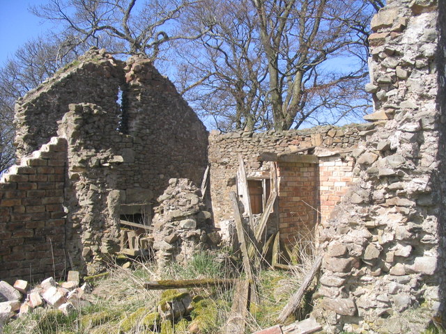
Commonside
Ruins for Commonside farmhouse.
 Map © Crown Copyright")
TIP: Click the map for more Large scale mapping
- Grid Square
- NT7357, 17 images (more nearby 🔍)
- Photographer
- Michael Anderson (more nearby)
- Date Taken
- Friday, 13 April, 2007 (more nearby)
- Submitted
- Friday, 13 April, 2007
- Subject Location
-
OSGB36:
 NT 732 574 [100m precision]
WGS84: 55:48.5474N 2:25.7306W - Camera Location
-
OSGB36: NT 732 573
- View Direction
- West-northwest (about 292 degrees)