2014
TA0928 : Wellington Street, Kingston upon Hull
taken 10 years ago, near to Kingston Upon Hull, England
This is 1 of 21 images, with title Wellington Street, Kingston upon Hull in this square
Wellington Street, Kingston upon Hull
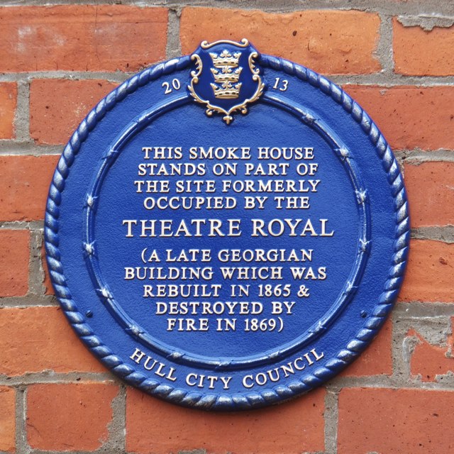
Nos.12-13 Wellington Street. Refurbishment of 1930s smoke house with distinct funnel-shaped chimneys. Originally for curing fish, later meat. Following demolition of the surrounding warehouse, cleared area laid out as open space with seating and planters to edge of the pavement.
Depicted is one of two heritage plaques dated 2013 affixed to the façade of the building: TA0928 : Wellington Street, Kingston upon Hull
Depicted is one of two heritage plaques dated 2013 affixed to the façade of the building: TA0928 : Wellington Street, Kingston upon Hull
 Map © Crown Copyright")
TIP: Click the map for more Large scale mapping
- Grid Square
- TA0928, 6574 images (more nearby 🔍)
- Photographer
- Bernard Sharp (more nearby)
- Date Taken
- Thursday, 5 June, 2014 (more nearby)
- Submitted
- Friday, 6 June, 2014
- Subject Location
-
OSGB36:
 TA 0996 2823 [10m precision]
WGS84: 53:44.3321N 0:20.0618W - Camera Location
-
OSGB36: TA 0996 2823
- View Direction
- West-southwest (about 247 degrees)